
 Yahoo Lifestyle
 Met Office warns ‘worst is yet to come’ as UK deluged by heavy rain and thunderstorms

The UK is being battered with heavy rain this week as the Met Office warned the worst is yet to come.
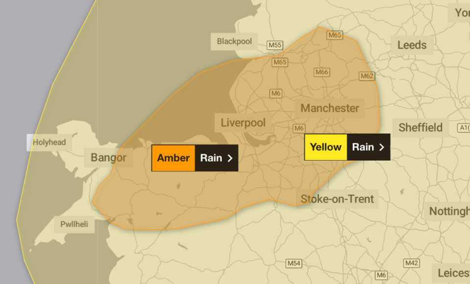
The forecaster issued an amber warning for rain across parts of north Wales and northwest England, including Manchester and Liverpool, between noon on Wednesday and the same time on Thursday.
Fast-flowing or deep floodwater is likely and there is good chance some communities could become cut off, suffer power cuts and see travel disruption, the Met Office said.
A yellow warning for rain also covers the north of England, the Midlands and north and central Wales until 6am on Thursday, while another is in place for southern and eastern Scotland from midday on Wednesday until 6pm Thursday.
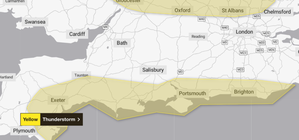
Much of the south coast is expected to see lightning, with a yellow warning for thunderstorms in place from 8am until 7pm on Wednesday.
Met Office meteorologist Tom Morgan said on Wednesday: “There was a lot of rainfall overnight in the north-west and southern Scotland, as well as in areas such as the Midlands, East Anglia and the Home Counties.
“The wettest area was Drayton Parslow in Buckinghamshire which saw 68.8mm in the last 24 hours. That’s almost a month’s rainfall in one day. For comparison, most other areas have seen an average of half a month’s rain in the same amount of time.
“But the worst is yet to come. There is a lot of rain still to come in the next 12 to 24 hours, particularly in north Wales and north-west England. There could be some flooding in north Wales until midday on Thursday.”
Many places could see 30-40mm of rain, while a few areas may receive 60-80mm. There is a small chance a few upland areas could see up to 150mm, the forecaster said.
It comes after top climate scientists warned human-induced climate change has made downpours and rainfall across the UK and Ireland more intense with the region facing wetter weather in future.
The World Weather Attribution study found rainfall during storms across the UK and Ireland between October 2023 and March 2024 was made 20 per cent heavier by global warming.
The UK and Ireland saw 13 to 14 severe storms in 2023-24, which caused 13 deaths and widespread damage across the two countries - with similar heavy rainfall ten times more likely in future.
The Met Office said the south of England had its wettest February in a time series going back to 1836, with many parts of the region recording well over twice the average rainfall for the month.
Meanwhile, East Anglia has experienced both its warmest and wettest February on record, with an average of 106.4mm of rainfall across the month, beating the previous record of 95.2mm set in 1916, and a mean temperature of 8.2C, surpassing the previous record of 7.6C set in 1990.
The UK as a whole experienced its second warmest February, with a mean temperature across the month of 6.3C, behind the record of 6.8C set in 1998.

